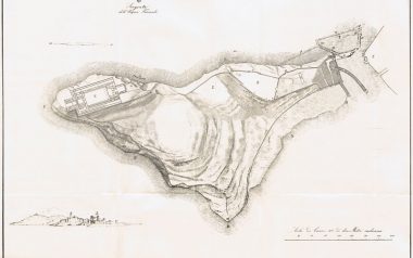
Sirmione fortifications
Over the centuries, the Sirmione peninsula was a focal point for the control of Lake Garda. The Romans had already made it the place of an important task at the base of the peninsula on the Gallic Way between Brescia and Verona; place furnished with posts, lodgings for officers and emperors, where there were the stores of food stocks for armies and held in high esteem for the sustenance of the armies while, the fortified part, with two ports, the citadel, a probable stronghold on the hill of Cortine and, on the northern tip, the large villa with baths now called Grotte di Catullo were placed at the tip of the same.
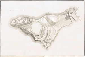
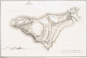
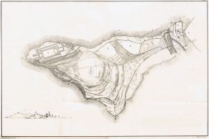
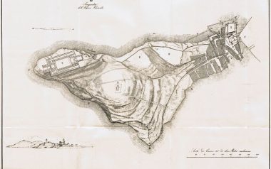
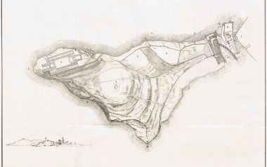
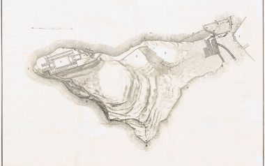
About Sirmione fortifications makes a detailed study Count Giovanni Girolamo Orti Manara (1769 – 1845) in his “The peninsula of Sirmione” of 1856, in which he inserts drawings concerning his studies, researches and excavations at the tip of the peninsula in search of various historical steps. It follows that at the time of the Romans the tip of the peninsula was actually an island largely surrounded by walls of protection (later studies will date the fortifications in the late Roman period of the fifth century), in the part closest to the peninsula there were two ports, one to the east well protected by the fury of winds and waves; one to the west, easy and without great protections, both connected to the fortified citadel, protected by walls and from which one accessed an intermediate zone and then to the fortress, positioned on the hill of Cortine; another large protected area included the hill of the next church San Pietro in Mavinas and the large Roman villa. It should be noted that on the basis of some occasional finds in the center of the village and of what Manara writes: “on the floor of this mountain, within the circle of the walls, many foundations of houses with mosaic floors emerged.”; easily then, before the period of the fortifications of the fifth century, the houses of the island were not to be of modest conditions, but holiday villas of wealthy families probably coming from the nearby and important cities of Verona or Brescia. Since the fourth century, however, naval fleets are prepared on rivers and lakes, it is also supposed that of Garda, for the reinforcement of the armies engaged on the northern borders, hence the need to fortify ports.
Later, around the sixth century, Theodoric decided to restore navigability on the Mincio recreating a military fleet that needed then fortified ports in the lower Garda; the Roman setting was not distorted, retained much of the previous works extending them and creating the walls further south to the citadel, also using part of the Roman villa in via Antiche Mura (III century). Inside the new fortified circle of documents of the eighth century attest that the monastery church of San Salvatore, the church of San Vito and that of San Martino were built, while the same confirm that the church of San Pietro in Mavinas was external in the circle.
Towards the end of the 8th century and the Longobard domination, there was a certain Cunimondo, a great landowner who murdered a courtier of Queen Ansa, in Sirmione, because of this, with deed of Charlemagne of 774, all the assets were confiscated including the peninsula and property date at the convent of San Martino di Tours.
This episode and other events shifted interest to other castles of the lake until the thirteenth century, when the Scaligeri family began to take great importance in the political and military scene of northern Italy. In 1276 Sirmione captures the Cathar heretics by Alberto della Scala and this gives a new light to the Scala family in the eyes of the emperor and the Pope, so the politics of Verona has a new impulse and Sirmione is listed with Peschiera, Malcesine, Garda, Villafranca and others in the statutes of Verona as fortified border areas to keep operating, there being all the interest to keep the lake as a commercial street. Hence the decision to modify and reinforce the castle and the fortifications of Sirmione with a new approach, which placed the castle at the beginning of the island and, with the two drawbridges, in a position to defend itself both from external attacks and attacks internal to the country.
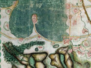
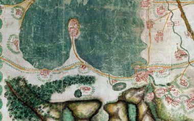
At the base of the peninsula passed the road between Brescia and Verona that the Manara, referring to Filiasi, defines the Via Gallica (which leads from Gallie, to Turin, Milan, Bergamo, Brescia, Vicenza, up to the Strait of Constantinople), flanked in this stretch by the Lucana forest that extended up to the Mantuan area; here was the Roman Mansio, from various studies identified in the building that is now the “Trattoria Vecchia Lugana”, from here started the road that bordered the lake and entered the peninsula, but that over time has fallen into the lake and has been replaced from the current most to the west. In front of the mansion there must have been a port, of which there are still signs in the lake, agglomerations of large stones and remains of wooden palisades visible from the aerial photographs. These various clues, together with the discovery of Roman coins of various periods and other artefacts, suggest that the area was a place of considerable passage and communication, thanks to the ports, with the north of the lake, a viable alternative to the land route along the valley of the Adige.
